Summer expedition to Aletsch Glacier 2025
A trip to the glacier is an opportunity to bring the algorithms to life. From the 4th to the 19th of July 2025, Danielle Gunders-Hunt (FAU Erlangen-Nürnberg, M3OCCA) and Valentin Marx (FAU Erlangen-Nürnberg, M3OCCA affiliated) were situated at the Jungfraujoch research station in Switzerland to collect radar measurements using custom-built radar systems.
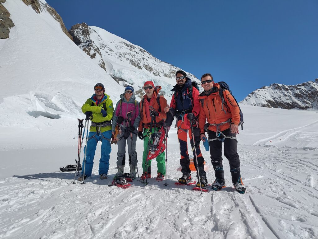
This summer’s fieldwork took us to the Aletsch Glacier in Switzerland. We drove to Grindelwald on Thursday and met up with colleagues from RWTH Aachen and the University of Wuppertal, affiliated with the TRIPLE project. After an impressive gondola ride and train journey through the mountain, we arrived at the research station located at 3,454 m a.s.l.

The research station is home only to researchers and is managed by a couple who oversee the High Altitude Research Stations Jungfraujoch & Gornergrat. They showcased the fascinating equipment held permanently on the glacier, ranging from instruments measuring air constituents for climate change monitoring, to medical and biological experiments observing the influence of high altitude on organisms.
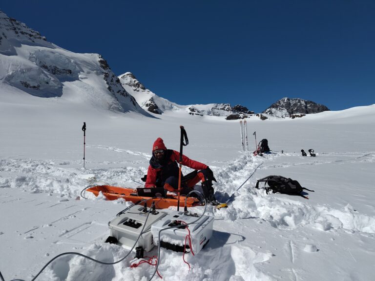
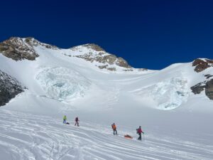
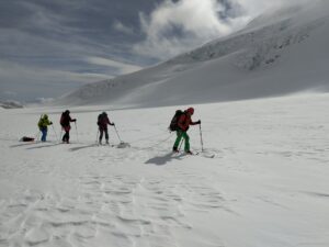
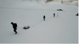
The next day we began with a guided tour led by a mountain guide to learn the basic rescue techniques and familiarize ourselves with the glacier terrain. Unstable weather in the first few days caused some delays, but we soon began carrying out our full set of measurements with the GPR sled.
Our goal was to evaluate our equipment in various walking formations to assess the efficiency of each imaging method. Different formations can leverage different algorithms to generate 2D or 3D images of the snow and firn layers, as well as crevasses hidden beneath the surface.
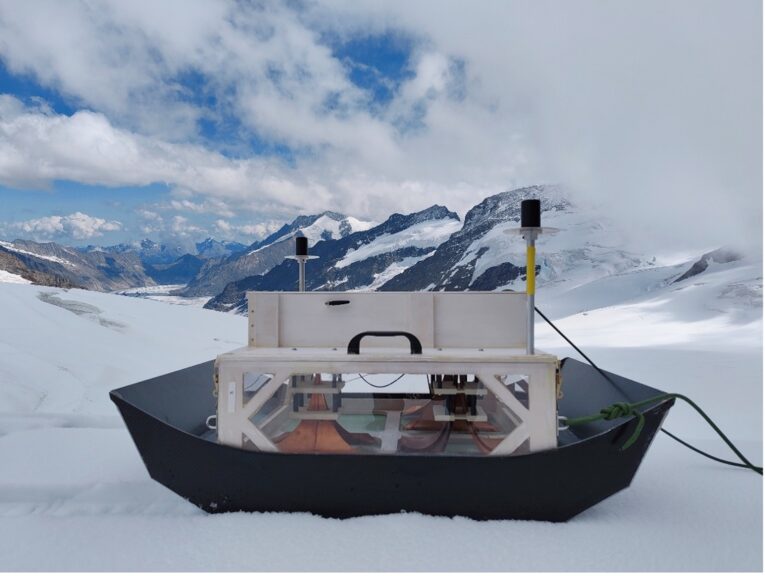
Both radar systems used during the campaign were developed in-house at the Institute of Microwaves and Photonics (LHFT), FAU Erlangen-Nürnberg. The first system was an impulse radar operating at a center frequency of 1.35 GHz. Impulse radar transmits short, broadband pulses and listens for echoes reflected from internal glacier boundaries—such as transitions between snow, firn, ice—or from embedded features like crevasses, air pockets or water inclusions. We then replaced the radar system with a frequency-modulated continuous wave (FMCW) radar, ramping between 0.7 and 4.7 GHz. Unlike impulse radar, FMCW continuously emits a frequency-modulated signal and compares the transmitted and received waves to measure the time delay and amplitude of returning echoes. This method offers improved sensitivity and resolution, especially for fine structures near the surface.
We are now looking forward to analyzing how each type of radar—together with its frequency and signal power—affects both the penetration depth and the resolution of subsurface glacial features.
The fieldwork was a rewarding collaborative experience. Working alongside the TRIPLE team, who were testing a hybrid radar and sonar based forefield reconnaissance system integrated into a melting probe, reaching 12 m beneath the surface, gave us valuable insights into subsurface structures which we hope to cross-validate with our radar results.

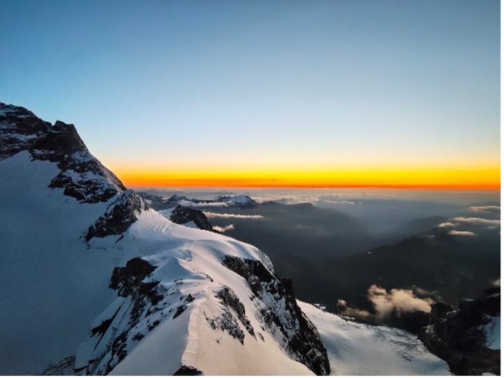
Beyond the scientific goals, sharing meals, challenges, and ideas made the high-altitude days both productive and memorable. Each evening, breathtaking sunsets from the Sphinx Observatory (3,570 m a.s.l.) reminded us how extraordinary our setting truly was—it felt like we were on top of the world!
This campaign wouldn’t have been possible without the support of Valentin Marx, Lukas Rechenberg, and Niklas Haberberger, as well as the remaining colleagues from the TRIPLE-FRS-2 project.
The M3OCCA project is generously funded by the Elitenetzwerk Bayern.