IceAnatomy: a benchmark dataset and methodology for automatic ice boundary extraction from radio-echo sounding data
Understanding how glaciers are changing is key to predicting future sea-level rise and the impacts of climate change. To do this, we need to know how thick the ice is and what the ground looks like underneath. Traditionally, this information comes from radar measurements that show cross-sections of glaciers but analyzing these images by hand takes a lot of time and effort.
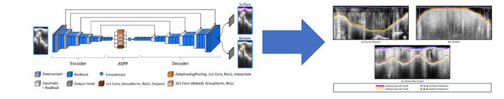
In our project, we created IceAnatomy, the first open and standardized collection of glacier radar data designed to train and test computer models that can do this work automatically. The dataset includes more than 45,000 kilometers of radar observations from Antarctica and Patagonia, along with precise human-made references.
By sharing IceAnatomy and the deep-learning model, we make it easier for researchers everywhere to develop faster, more accurate tools for studying ice thickness. This helps the scientific community better monitor glaciers and understand how our planet’s frozen regions are changing.
Publication available on: https://doi.org/10.5194/tc-19-5337-2025