9 positions for doctoral candidates (m/w/d)
As part of the second funding phase, the International Doctorate Program „Measuring and Modelling Mountain Glaciers and ice caps in a Changing Climate” (IDP M³OCCA) at the Friedrich-Alexander-Universität Erlangen-Nürnberg (FAU) announces
9 positions for doctoral candidates (m/w/d) (75/100%, E13 TV-L).
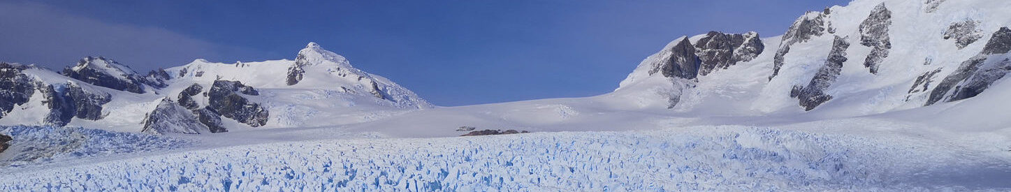
The Doctorate Program aims at developing methods, sensors and models for improved monitoring and understanding of glacier changes. The individual doctoral projects range from the further development of a multi-frequency digital radar system and tomographic SAR methods for deriving snow and firn structures, to machine learning approaches for analyzing satellite data and radargrams with regard to various glaciological variables. Further subprojects will focus on improving geophysical models concerning glacier ice dynamics, snow drift and local meteorology, and firn densification. In addition, one project addresses the closer integration of ice-dynamic modelling and permafrost research in high alpine environments. Accordingly, the IDP brings together expertise from Geography, Geosciences, Geophysics, Computer Science, and Electrical Engineering.
The program is funded by the Elite Network Bavaria of the Bavarian State Ministry of Science and the Arts, and is coordinated at FAU Erlangen-Nürnberg with joint participation of the Technical University Munich, the Bavarian Academy of Sciences and the German Aerospace Center in Oberpfaffenhofen. The accompanying training program includes content from all participating disciplines, offered through colloquia, workshops, and research retreats.
The working language within the IDP is English. All positions run for 4 years and are set to begin on 1 June 2026.
The specific descriptions of the subprojects (SPs), job announcement and contact details of the respective supervisor can be found here:
The aim of this subproject is to develop a concept that enables a situation-dependent analysis of glacial structures, depending on, e.g., the water content and the heterogeneity of the medium as well as the clutter level of the measurement site. The GPR platform developed in phase 1 will function as a versatile setup, which can be adapted and refined to implement this functionality. Adapting the imaging modality depending on the individual measurement conditions will provide profound and high-resolution insights into the hidden world of glaciers. In order to image and analyze highly inhomogeneous ice masses as to be found in alpine glaciers, it is necessary to adapt existing signal processing concepts to multi-layered media. Therefore, it is important to intensively study and simulate the different effects on radar waves in multi-layered media. Understanding those different effects, and their contribution to radar imaging in heterogeneous media, will enable a new level of subsurface imaging of glaciers and ice masses using synthetic aperture focusing.
Click here for the job announcement of this subproject.
In this project we will explore and estimate a physical glaciological parameter like snow/firn density. The electromagnetic SAR wave is sensitive to the density of the snow/firn/ice media, specifically that the propagation speed and the scattering within the media is changing with changes in the media. The influence of the density on the signal is visible and in turn could be inverted from the signal. In our research group we started to analyze the effect on the signal using simple canonical electromagnetic models and exploring the polarimetric imaging mode of SAR. The idea is to extend the observation space from polarimetric acquisitions to polarimetric SAR interferometry and potentially even to SAR tomography to estimate the density parameter. In addition, we like to compare the results obtained with a physical glaciological model that is reconstructing the media and providing a reference density that can be used to compare it with the obtained estimate from the SAR electromagnetic model.
Click here for the job announcement of this subproject.
We will focus on advancing research in continual learning and foundation models to improve the robustness and adaptability of glacier surface and bedrock detection. Continual learning will allow our models to incrementally learn from new radar data without forgetting previously acquired knowledge, ensuring they remain effective across varying conditions. Foundation models, with their ability to generalize across diverse tasks and domains, will be adapted to handle the unique challenges of glacier monitoring, such as varying radar systems and geo-locations. This approach will support the development of models capable of adapting to new environments while minimizing the need for extensive retraining.
Click here for the job announcement of this subproject.
We aim to expand our current activities on the derivation of glacier outlines over debris covered areas in phase 2 with more test sites and in particular enlarge the database with different sensors and back in time. We will test additional algorithms on their performance on this database. As a second objective, we will expand the classification of surface types, specifically of debris covered areas. This will enable to investigate if debris covered surfaces may increase. A next step would be to combine this data with a debris cover thickness inversion to assess impacts on the energy and surface mass balance. Combining the three layers of outlines, debris cover change and thickness would then enable better quantifications and explanations of glacier changes as well as provide input for ice dynamic and surface mass balance models.
Click here for the job announcement of this subproject.
The first aim of this subproject is to further consolidate the developed deep learning architectures for the estimation of the radar penetration bias at X-band and to improve the performance, by concentrating on the analysis of advanced deep learning-based approaches, such as multi-task learning or the use of visual transformers (ViTs). Then, we propose to extend the research topic to other radar frequencies, such as C-band and L-Band. This will allow us to derive robust architectures to be applied to other interferometric radar missions for monitoring surface height changes on glaciers and ice caps. In particular, regarding C-band, the focus will be on existing SRTM bistatic InSAR data, acquired in 2000 with a single baseline, and airborne radar data acquired by the DLR sensor F-SAR. This will allow for improving the measurement of height differences occurred within a time span of more than 20 years, by combining both SRTM and TanDEM-X data. Furthermore, this activity is also highly interesting in view of future bistatic missions, such as the ESA C-Band Harmony Earth Explorer mission. Regarding L-band, similar research assets will be performed, aiming at linking the InSAR observables, such as backscatter and coherence, to the height of the surface, in view of ongoing and future missions such as JAXA ALOS-4, NASA NISAR and ESA ROSE-L.
Click here for the job announcement of this subproject.
Based on an improved firn densification scheme developed during the previous phase of M³OCCA, we will improve the estimates of the mass contribution of the firn body to the mass balance of glaciers on a local scale. However, firn densification is a highly time dependent process, especially during periods with strong climatic changes. In addition, not only densification, but also (spatial as well as depth) extent of the firn is determined by the local conditions. In order to extend the physical densification scheme on a regional scale it is necessary to develop a suitable strategy. Based on the achievements of the first phase, it is planned to link the developed densification scheme with regional climate information of the past decades and suitable topographic data in order to produce a realistic spatially distributed firn stratigraphy on a regional scale and in a suitable test region. The test region needs to be large enough to be representative for the analysis of satellite-based information in the visible and microwave spectrum. This will allow us to derive relations between the evolution of the visible firn extent, the microwave backscatter and the modelled firn conditions. Validation will be achieved by geophysical methods of velocity/depth and density estimates, developed during the first phase. The final modelling chain will be capable of determining the firn share to the total glacier mass and its temporal evolution, which is crucial for the future prediction of regional glacier mass balances from space.
Click here for the job announcement of this subproject.
In this subproject, we aim to put a recently developed machine-learning model of snowdrift and local atmospheric flow to use by following a two-tier concept. First, we would apply the new model to various real cases (suitable data besides Hintereisferner exist for, e.g., Greenland, Svalbard and Patagonia) and simulation periods of several years (or even 1-2 decades). The result will be a precise quantification of the snow drift term in glacier mass budgets. This would generate an outstanding, climatological insight into the snowdrift importance on glaciers. Secondly, we plan to construct a simple parameterization from our snowdrift model, which can be incorporated in stand-alone mass balance models for worldwide application. This step would push the determination of glacier mass budgets to the next level, as snowdrift is typically neglected in the current determinations.
Click here for the job announcement of this subproject.
A holistic description of ice-dynamics, coupled simulations of the temperature and ice-dynamic evolution are key for a better understanding and reliable projections of glacier retreat and of future susceptibility for mountain hazards. In this subproject, we therefore focus on exploiting ML techniques for englacial temperature evolution and integrating them into thermo-dynamically coupled glacier evolution models. Reliable estimation of glacier temperatures requires multi-centennial or millennial simulations, implying a significant computational challenge. Moreover, the advective character and the concentration of shearing near the glacier base imply severe time-step limitations. Existing ML techniques for scalar transport are forward as remedy for this computational bottleneck. This sub-project can directly help to speed-up enthalpy simulations in SP3.3.
Click here for the job announcement of this subproject.
Intensified warming, precipitation extremes, permafrost loss and glacier retreat will increase the risk for natural hazards in mountain regions. Particularly, warming mountain permafrost is a key process in destabilizing/triggering predisposed rock slopes. Yet, not much attention has been directed to the thermal interplay of the ice body and the sub-surface during glacier retreat. A multitude of processes is involved in the downward propagation of the thermal signal from the surface. These comprise diffusion, advection, (melt-)water percolation/infiltration, subsurface refreezing/melting, frictional warming and subsurface water routing. We anticipate to employ a comprehensive enthalpy approach integrated in a glacier evolution model. The Vernagtferner can serve as ideal test site with regard to the extensive glaciological and geomorphological field observations. Cold-ice transitions within the ice body are well visible in radargrams and can be compared to observations from SP1.1 and SP1.2. For the benchmark sites in SP3.1, glacier mass budget quantification might profit from englacial temperatures as boundary conditions.
Click here for the job announcement of this subproject.
Applications
Applications shall comprise a cover letter, CV, publication list (if applicable), certificates/transcripts of records of university degrees, contact details of two references as well as a concise research concept (2 pages) outlining potential research activities within the chosen topic. Applicants from universities outside Germany must hold the equivalent of a Master’s degree.
Please submit all documents as one file (PDF) via email to idp-mocca@fau.de and relate to the respective sub-project in the subject. Applications for various sub-projects are feasible. In this case we ask the candidates to name priorities. The screening of applications will start on 7 December 2025.
For project-specific questions, please contact the respective project supervisors directly. General questions about the IDP can be directed to the coordinator Dr. Franziska Temme (franziska.temme@fau.de) or the spokesperson Prof. Dr. Matthias Braun (matthias.h.braun@fau.de; Institut für Geographie, FAU Erlangen-Nürnberg, Wetterkreuz 15, D-91058 Erlangen).
The FAU is seeking to augment the number of women in research and teaching and specifically addresses female scientists to apply for these positions. We further encourage persons with disabilities to apply. If desired, a member of the equal opportunity office of FAU can participate in the selection process without any disadvantage for the applicant.